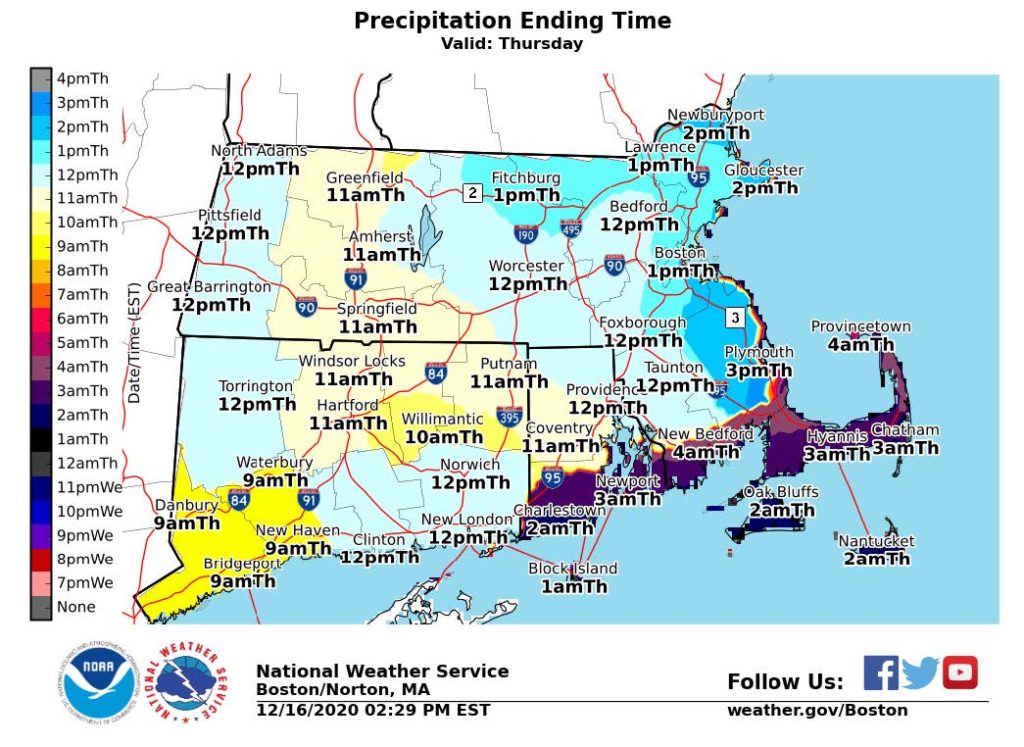
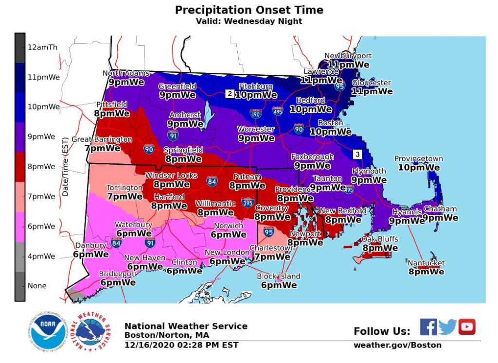
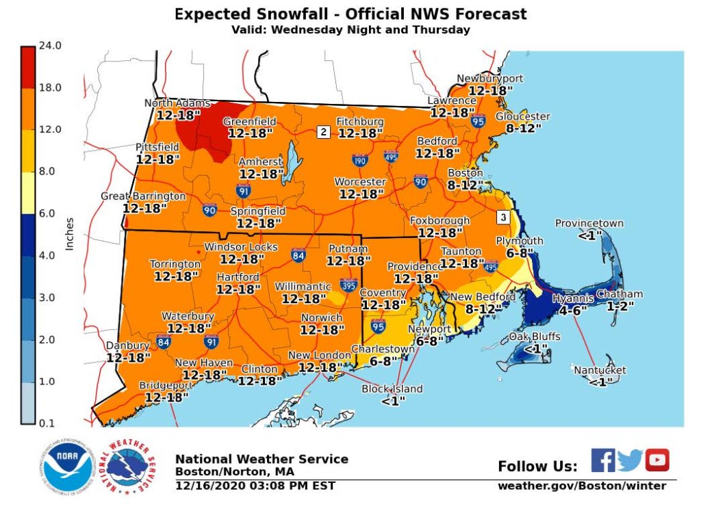
- Significant snow accumulation is anticipated in southeastern Massachusetts creating issues with travel and commuting on Thursday morning.
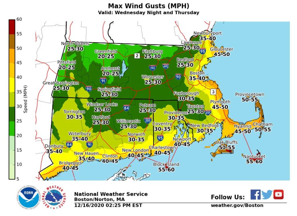
- Strong wind gusts
- Blowing/drifting snow
- Isolated/scattered power outages
- Wind gusts between 45 – 55MPH along the coast and over Cape Cod and the Islands.
- Winds will increase around midnight with the strongest wind gusts occurring between 7am and 1pm Thursday.
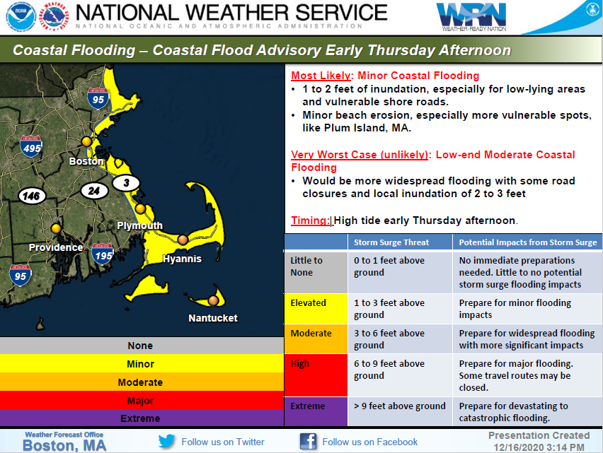
- The Massachusetts coast including Cape Cod and the Islands could see minor to low- end moderate coastal flooding (1-2 feet of inundation) during high tide on early Thursday afternoon.
- Flash freezing causing slick roads due to rapidly freezing temperatures may occur mid to late Thursday morning in in southeastern MA.
The Multi-Agency Coordination Center (MACC) continues to monitor this situation. The MACC is designed to provide local Emergency Operations Centers (EOCs) with resources and information during major countywide or regional incidents. The MACC captures, consolidates, and coordinates local requirements and communicates and coordinates with regional, state, federal, utility, and non-governmental resources to deliver requested resources back to the local EOCs.


